


Harris Grove Voting District, York County, Virginia
About
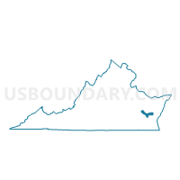
Outline

Summary
| Unique Area Identifier | 682730 |
| Name | Harris Grove Voting District |
| County | York County |
| State | Virginia |
| Area (square miles) | 89.07 |
| Land Area (square miles) | 7.07 |
| Water Area (square miles) | 82.00 |
| % of Land Area | 7.94 |
| % of Water Area | 92.06 |
| Latitude of the Internal Point | 37.22091380 |
| Longtitude of the Internal Point | -76.39553290 |
Maps


Graphs
Select a template below for downloading or customizing gragh for Harris Grove Voting District, York County, Virginia


Neighbors
Neighoring Voting District (by Name) Neighboring Voting District on the Map
- Achilles Voting District, Gloucester County, VA
- Chesapeake Voting District, Mathews County, VA
- Dare Voting District, York County, VA
- Eastern Voting District, Poquoson city, VA
- Edgehill Voting District, York County, VA
- Harwoods Mill Voting District, York County, VA
- Kiln Creek Voting District, York County, VA
- Precinct 1-1, Northampton County, VA
- Precinct 2-1, Northampton County, VA
- Sarah's Creek Voting District, Gloucester County, VA
- Seaford Voting District, York County, VA
- Yorktown Voting District, York County, VA
Top 10 Neighboring County Subdivision (by Population) Neighboring County Subdivision on the Map
- District 1, York County, VA (14,741)
- District 3, York County, VA (13,554)
- Poquoson city, Poquoson city, VA (12,150)
- District 2, York County, VA (12,093)
- District 4, York County, VA (12,089)
- Gloucester Point district, Gloucester County, VA (6,839)
- York district, Gloucester County, VA (6,231)
- District 1, Northampton County, VA (2,231)
- Chesapeake district, Mathews County, VA (2,041)
- District 2, Northampton County, VA (1,523)
Top 10 Neighboring Place (by Population) Neighboring Place on the Map
Top 10 Neighboring Unified School District (by Population) Neighboring Unified School District on the Map
- York County Public Schools, VA (65,464)
- Gloucester County Public Schools, VA (36,858)
- Northampton County Public Schools, VA (12,389)
- Poquoson City Public Schools, VA (12,150)
- Mathews County Public Schools, VA (8,978)
Top 10 Neighboring State Legislative District Lower Chamber (by Population) Neighboring State Legislative District Lower Chamber on the Map
- State House District 96, VA (90,800)
- State House District 98, VA (75,266)
- State House District 91, VA (64,074)
- State House District 100, VA (52,095)
Top 10 Neighboring State Legislative District Upper Chamber (by Population) Neighboring State Legislative District Upper Chamber on the Map
- State Senate District 3, VA (211,723)
- State Senate District 1, VA (170,275)
- State Senate District 6, VA (152,346)
Top 10 Neighboring 111th Congressional District (by Population) Neighboring 111th Congressional District on the Map
Top 10 Neighboring Census Tract (by Population) Neighboring Census Tract on the Map
- Census Tract 503.03, York County, VA (5,775)
- Census Tract 503.06, York County, VA (4,893)
- Census Tract 1005, Gloucester County, VA (3,857)
- Census Tract 504.02, York County, VA (3,527)
- Census Tract 504.01, York County, VA (3,300)
- Census Tract 503.05, York County, VA (3,214)
- Census Tract 505, York County, VA (2,960)
- Census Tract 9901, York County, VA (0)
- Census Tract 9901, Mathews County, VA (0)
- Census Tract 9901, Northampton County, VA (0)